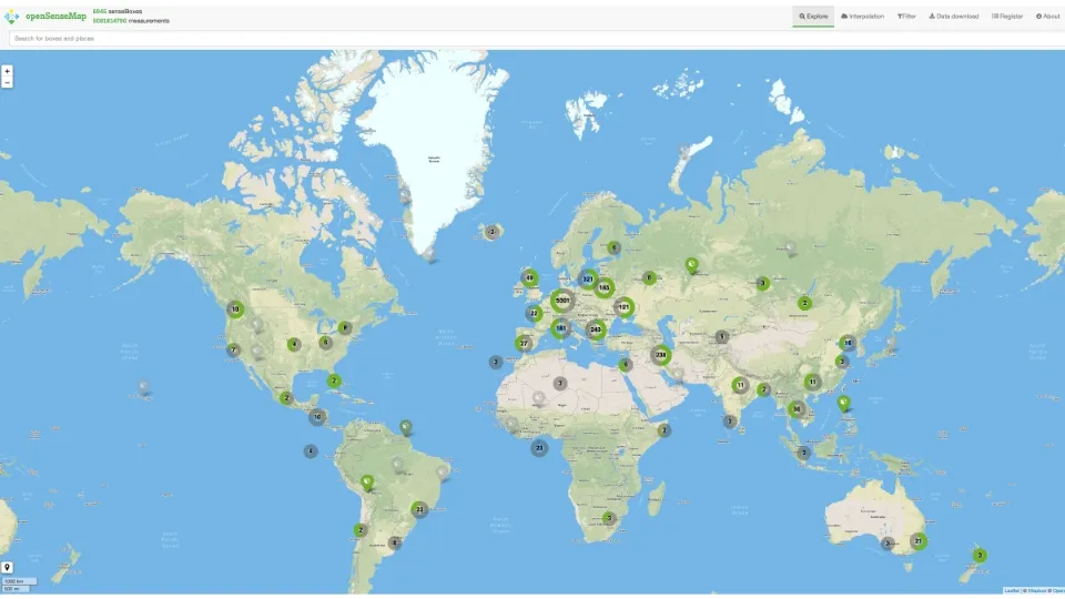
openSenseMap is a platform for open sensor data started in 2015 at the GI@School lab at the Institute for Geoinformatics in Münster. As part of the senseBox the project aims at educating pupils and citizens. It offers a platform for them to not merely share their environment sensor data but also to be able to view, download, and research worldwide data from other participants.
People from around the world publish the data they captured to answer various research questions as a citizen science project
How can this project help me?
The sensors measure, for instance, temperature, PM10, air humidity, air pressure, and indoor and outdoor air quality. The project is an excellent start to familiarizing oneself with IoT and learning fundamental programming skills. With the senseBox kits, you can build and program your own IoT devices. You will gain insights into technologies (keyword Smart Cities, Smart Home) that will revolutionize our everyday lives.
How can I use openSenseMap and what are its benefits?
As a scientist, you can use openSenseMap for your research work. Filter the data according to your needs and interests and download it to continue working with it.
If you are not working in science but are interested in the project and want to be part of it, register your sensor for it to appear on the world map and share your information with others. For those who have no connection with IoT and programming, we suggest a close look at the information on senseBox.
The repositories on GitHub contain, for example, the openSenseMap, openSenseMap-API, senseBoxMCU-core, and some others.